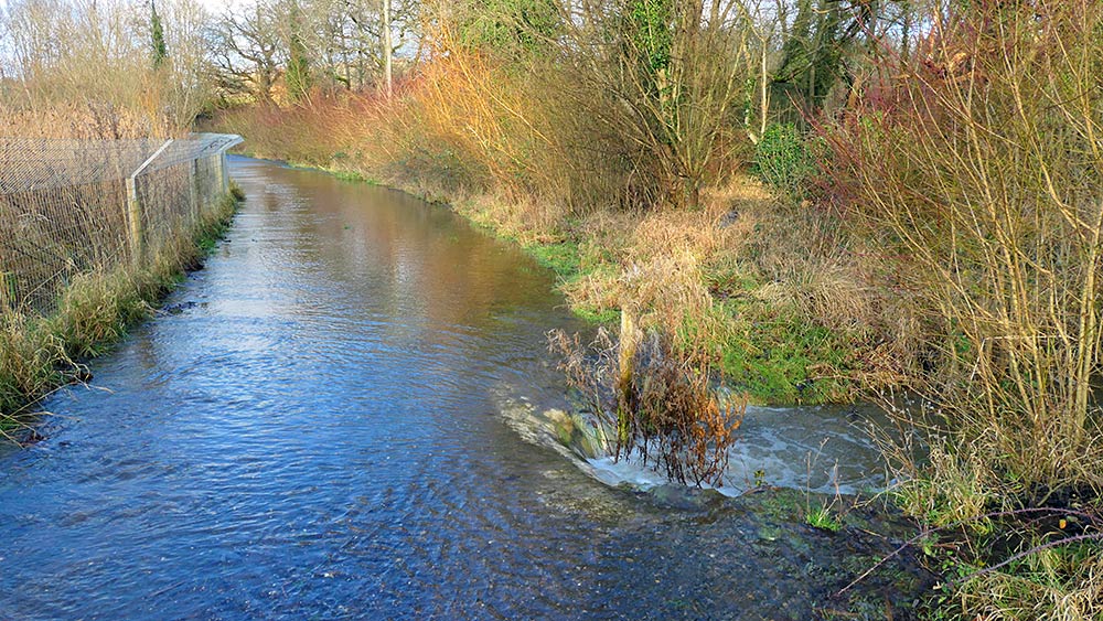
After a wet end to 2023 leading to saturated grounds in much of England storm Henk and shortly after some very heavy rain in early January brought some significant flooding to many parts of England. While not as serious as in some other parts of England there is also some flooding along the Kennet and Avon Canal in Aldermaston Wharf and Woolhampton in West Berkshire. I’ve lived here for 15 years and think on the stretch of canal I regularly walk it’s the worst it’s been in those years. There has been flooding before, but this year seems more and higher. On Saturday 6/Jan/2024 I went for my regular walk and took my camera with me for a few pictures and video:
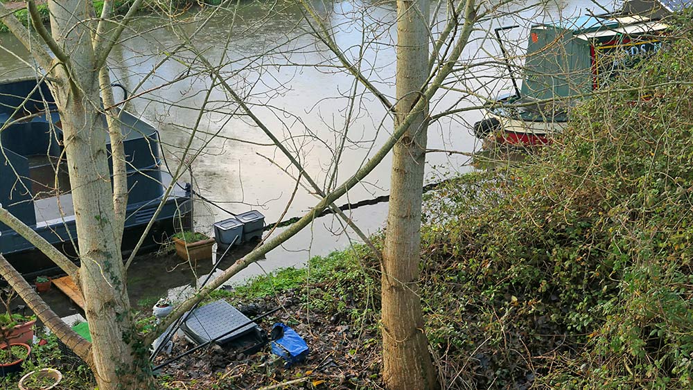
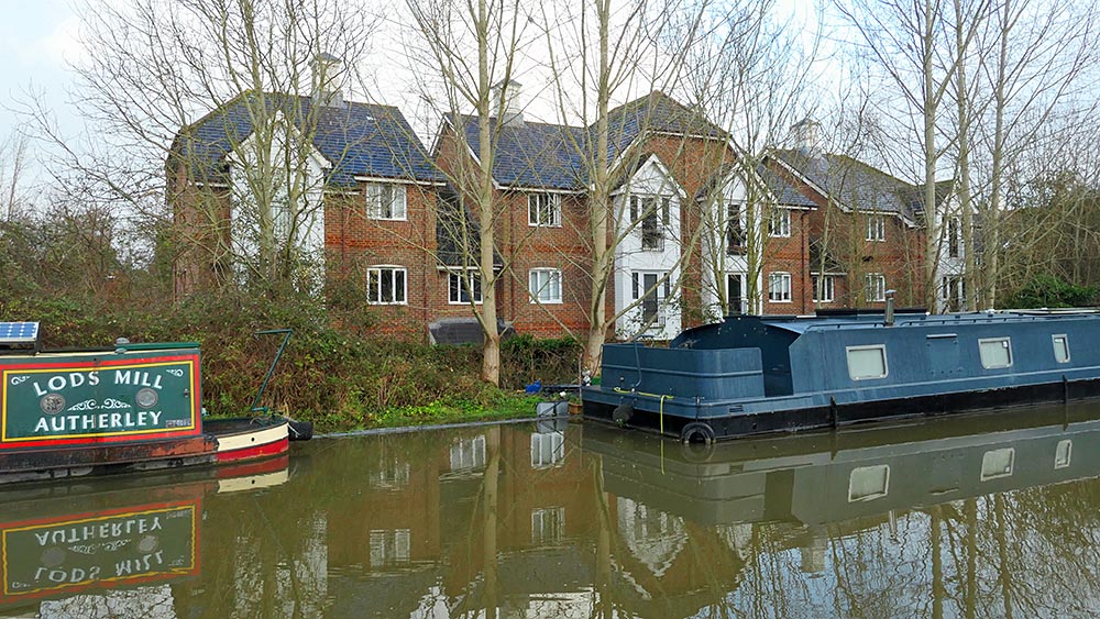
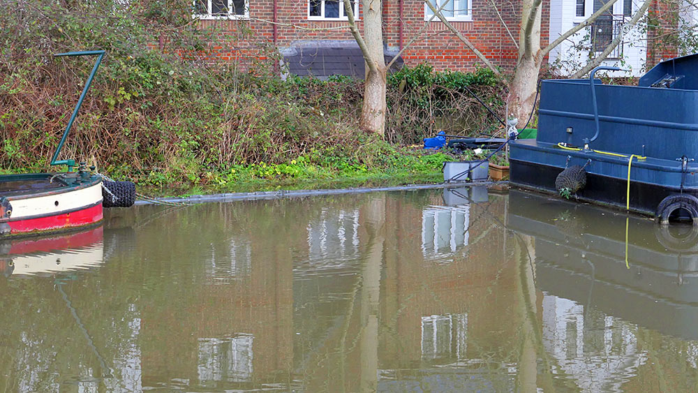
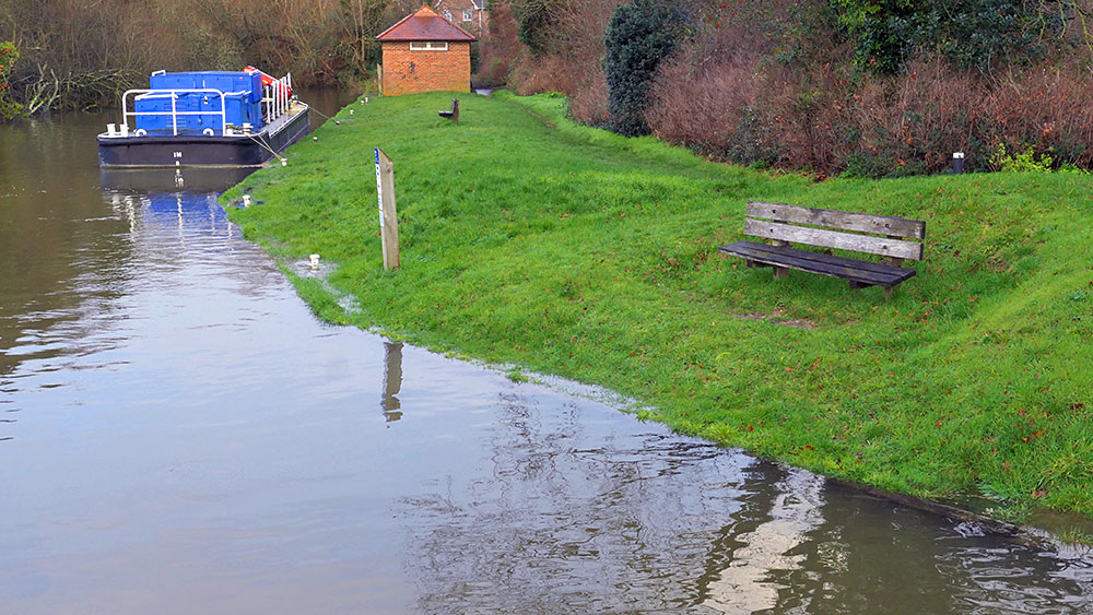
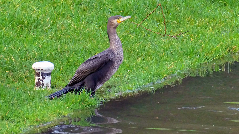
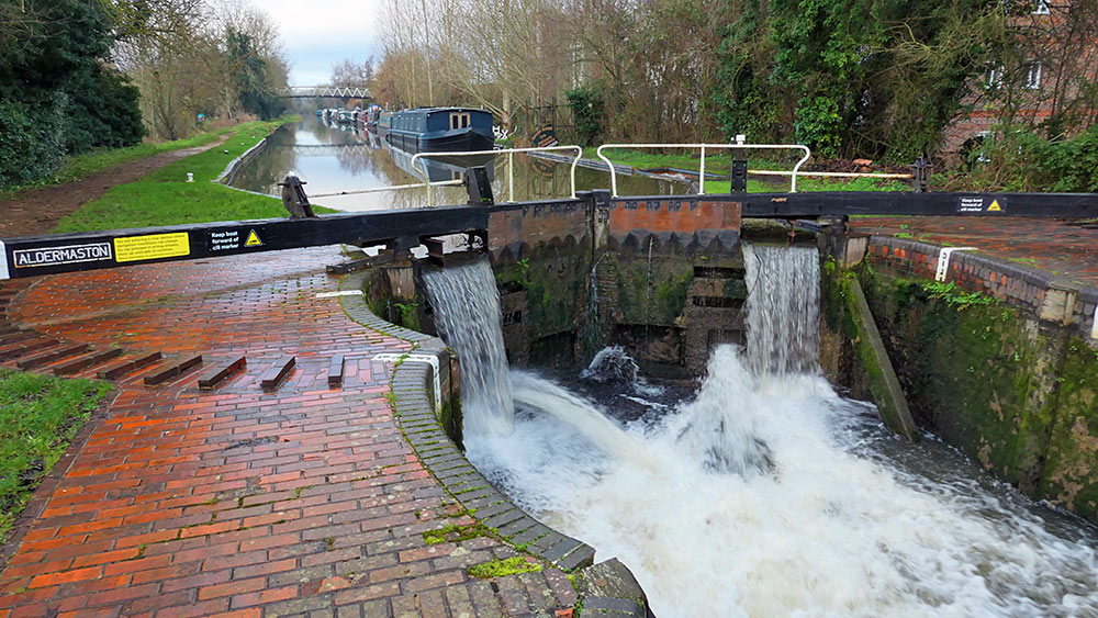
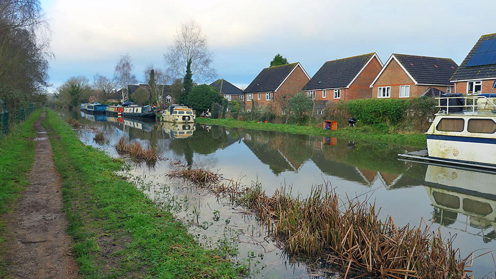
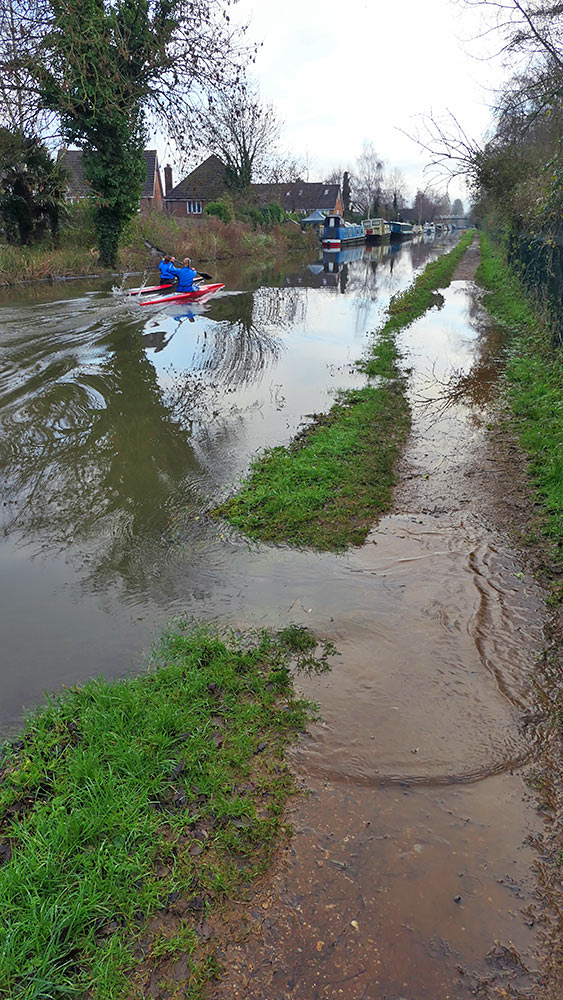
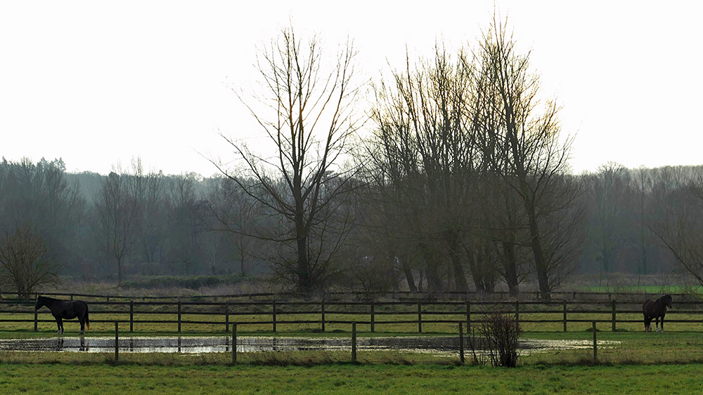
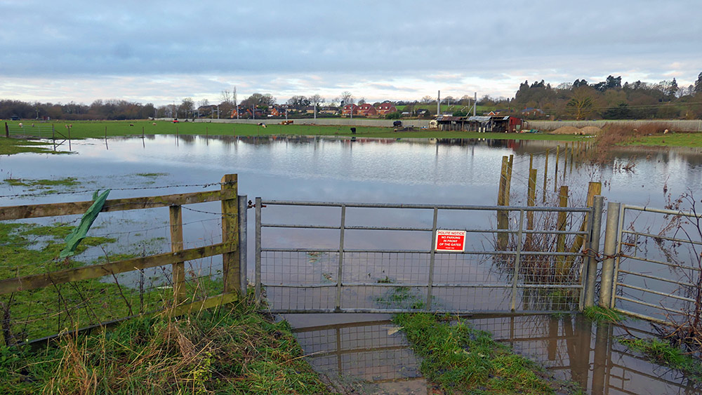
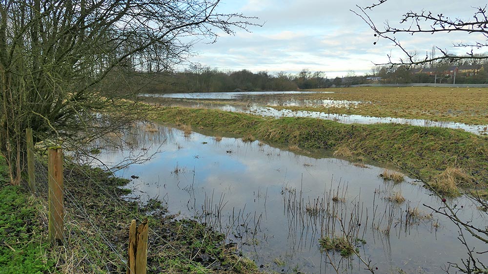
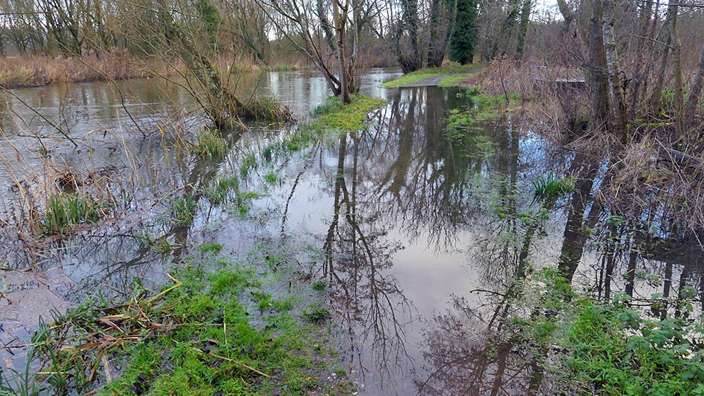
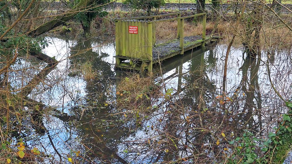
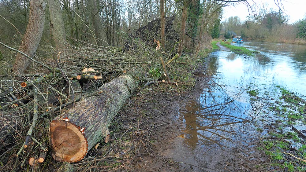
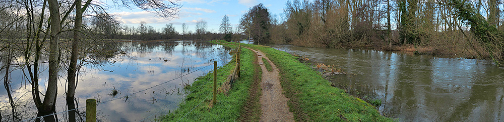
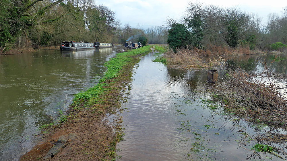
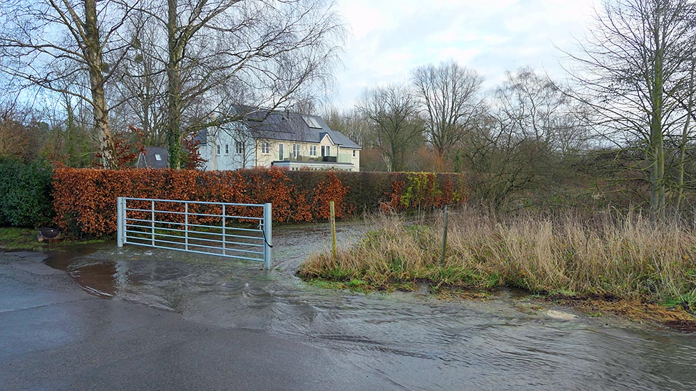
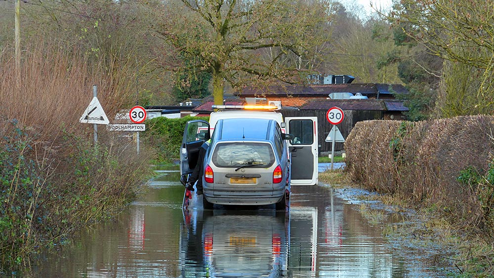
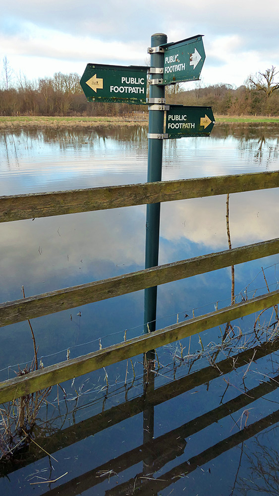
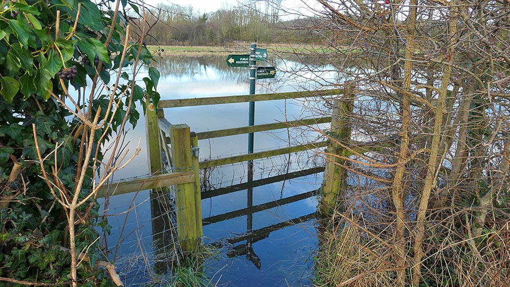
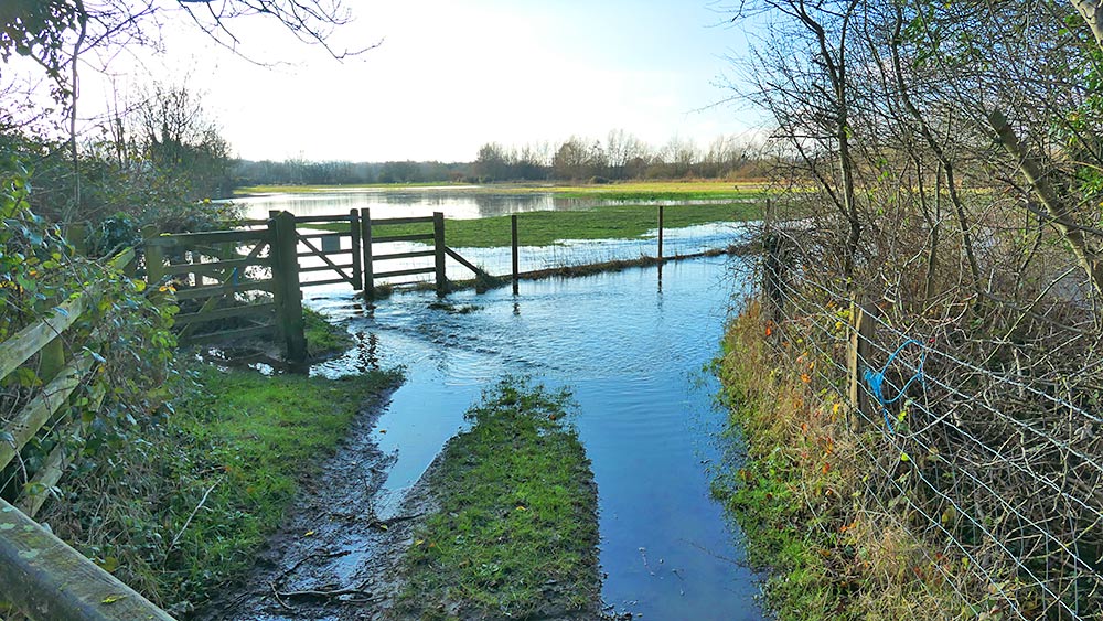
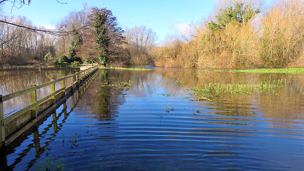
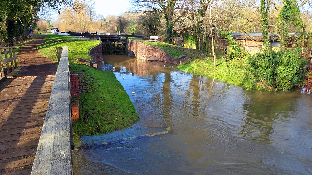
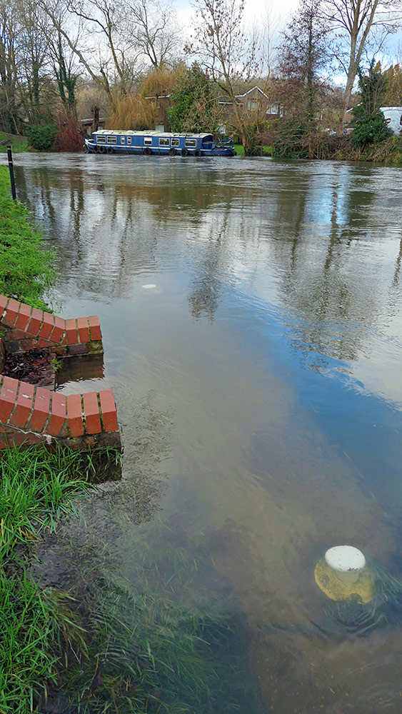
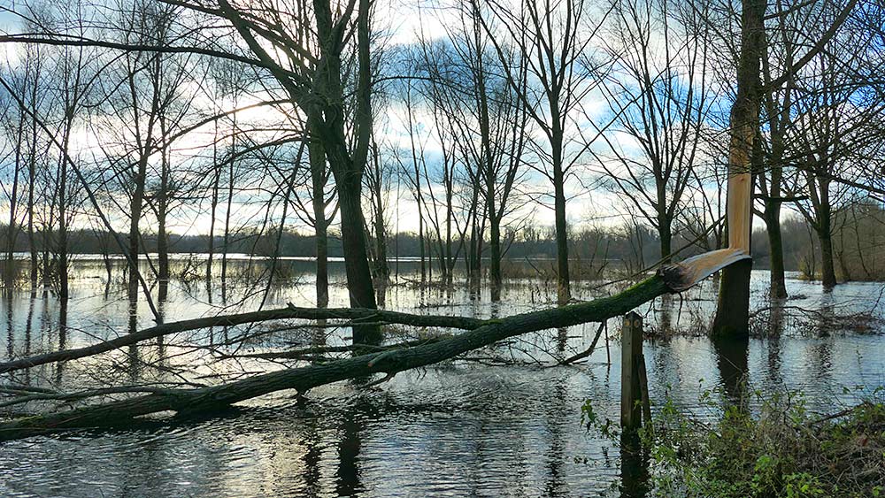
01 – View from my flat: A view out of a window from my second floor flat, the canal is level with and has flooded the path the boaters use to get to their boats at the permanent moorings02 – View of my block of flats over the canal: A view to my block of flats from the other side of the canal, The canal wall is only just visible next to the boats with the very high water level in the canal03 – Closer look at the canal wall outside my block of flats: A closer look at the canal wall outside my block of flats, showing the canal pretty much level with the top and flooding the path along the wall04 – Basin below Aldermaston Lock: Very high water levels in the basin below Aldermaston Lock,, going over the pier wall with a Canal & River’s Trust barge05 – Cormorant below Aldermaston Lock: Strictly speaking not the floods, but I spotted this Cormorant just below Aldermaston Lock. However, notice the very high water levels almost going over the top of the wall06 – Waterfall over the top of Aldermaston Lock: With the high water levels and huge amounts of water coming down the canal the overflow (just visible behind the right canal gate) can’t cope, so the water just goes over the top of the lock gates07 – High water levels in the Kennet & Avon Canal in Aldermaston Wharf: Very high water level in the Kennet and Avon Canal at the western end of Aldermaston Wharf08 – Flooded towpath in Aldermaston Wharf with passing kayakers: A flooded towpath at the western end of Aldermaston Wharf (doesn’t look that deep, but is actually ankle deep slightly further down). Two kayakers passing regardless (I believe the canal is currently closed for canal boats, don’t know about other craft)09 – New lake in the horse’s paddock: A new lake has appeared in the horse’s paddock10 – Flood at the gate to the sheep and cattle fields: I’ve seen these fields partially flooded before, but never as bad as this11 – Flooded field with a few sheep: This field often floods at the end where the trees are, but this time it’s flooded all the way to the fence. Some sheep are still in the field towards the right12 – Flooded towpath at the culvert: This stretch of the towpath has flooded before (making the culvert redundant), but I don’t think I’ve seen it that high and long before. I can remember it going just over the foot, this time it’s going well over the ankle13 – The bridge to nowhere: This bridge leads to some hidden hut in the woods with a very private owner. I don’t think he needs to worry much at the moment about visitors.14 – Fallen tree next to the flooded towpath: The fallen tree on the left was a victim of storm Henk just a few days earlier, the owner of the boat on the right told me he actually saw it falling. To their credit the canal trust cleared it up fairly quickly, making it easier to pass despite the flooding of the towpath15 – Flooded field and rushing canal panorama: A panoramic view near Woolhampton, a flooded field (sometimes used for cattle grazing) on the left, the canal in full flow rushing past on the right16 – Flooded football pitch at Woolhampton: Anyone for water ball?17 – Flooded towpath near Woolhampton: A heavily flooded stretch of the towpath just outside of Woolhampton. The two boats on the left were previously moored here, but had to give up their moorings as the bank had become too soft and dangerous18 – Flood rounding the corner: An impression from Station Road in Woolhampton, flood water coming from the lakes and the River Kennet is running down the road and then turns the corner to run down the track leading to the football pitch19 – Rescuing a drowned car: Another scene from Station Road, a rescue truck pulling out a drowned car20 – Flooded footpath sign: Don’t think anyone will use these footpaths for a while, the water was approaching the top of my wellies21 – Flooded footpath entrance Footpaths closed for now….22 – Flooded footpath and field: A flooded footpath and field near the Woolhampton lakes23 – Flooded car park and field at The Rowbarge and River Kennet Part of The Rowbarge car park heavily flooded on the left, the River Kennet in full flow approaching and flooding the field west of The Rowbarge24 – Flooding at the River Kennet footbridge and Woolhampton lock A view from the footbridge over the River Kennet, the mooring area outside Woolhampton lock is flooded25 – Flooded moorings at The Rowbarge The moorings at The Rowbarge are heavily flooded, the water well above the mooring bollards. It’s also up well over the first step of the stairs26 – Flooded track at the Woolhampton lakes The lakes at Woolhampton are overflowing, covering this track near Oxlease bridge27 – Flooded shores at the Woolhampton lakes The area around the lakes at Woolhampton (former gravel pits) is heavily flooded. The normal lake starts at the tree line 20 metres in front of it, but now everything around is flooded28 – Flooding at Woolhampton swing bridge Very high levels at the swing bridge in Woolhampton, going over the moorings for the bridge and into the gardens on the other side
I also recorded a few short video clips, here is the video I edited with them showing some of the flooding:
Floods around Aldermaston Wharf and Woolhampton, West Berkshire in January 2024
I hope you found the pictures and video interesting and informative, please let me know your thoughts in the comments.
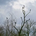
Yesterday I bought myself a new ‘travel and cargo trouser pocket camera’ (a [amazon_textlink asin=’B01AAU7T3A’ text=’Panasonic Lumix TZ100′ template=’ProductLink’ store=’thearmingrewehom’ marketplace=’UK’ link_id=’e6a0b17f-0748-11e7-8240-c53967e2d49c’]), as my old one simply wasn’t good enough anymore and was starting to show signs of its age. Today was a ‘walk day’ as part of my ongoing recovery from my heart surgery, so I took the camera out for a walk to the gravel pit lakes near Woolhampton. Here are a few early spring impressions from the walk:
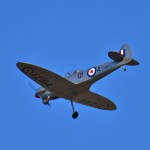
During a walk near Woolhampton and Brimpton Airfield on Saturday 19/Sep/2015 I spotted a Spitfire (at least that’s what I think it is) plane in the air. When I tried to look it up on the web I didn’t get very far, apart from that a Spitfire with the registration TZ164 was built in Aldermaston. What I didn’t find though was any information about this plane: Is it the real thing, well restored? Or is it a replica using the registration from the original? Or is possibly even a large scale model plane (although it seemed to be a bit too far from the airfield for that)?
If you have any information please leave a note in the comments. Thanks.
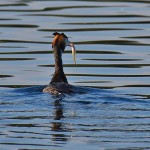
Went out for a long walk today from Aldermaston Wharf to the lakes (former gravel pits) at Woolhampton in some nice late Indian Summer sunshine. Mainly to gain some experience with a new lens for my camera I received on Friday. Among other birds spotted a Great Crested Grebe catching fish in the late afternoon light: